
Ntwetwe topographic map
Interactive map
Click on the map to display elevation.
About this map
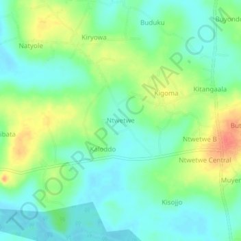
Name: Ntwetwe topographic map, elevation, terrain.
Location: Ntwetwe, Kyankwanzi, Central Region, Uganda (0.93472 31.55417 0.97472 31.59417)
Average elevation: 1,110 m
Minimum elevation: 1,092 m
Maximum elevation: 1,143 m