
La Palmita topographic map
Interactive map
Click on the map to display elevation.
About this map
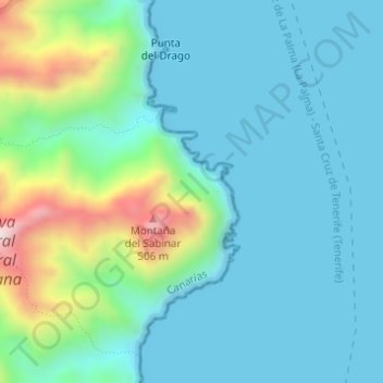
Name: La Palmita topographic map, elevation, terrain.
Average elevation: 110 m
Minimum elevation: -1 m
Maximum elevation: 540 m
Other topographic maps
Click on a map to view its topography, its elevation and its terrain.
Santa Cruz de Tenerife
Spanje > Canarische Eilanden > Santa Cruz de Tenerife
Santa Cruz de Tenerife, Canarische Eilanden, 38004, Spanje
Average elevation: 181 m