
Hornby Island topographic map
Interactive map
Click on the map to display elevation.
About this map
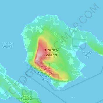
Name: Hornby Island topographic map, elevation, terrain.
Average elevation: 26 m
Minimum elevation: 0 m
Maximum elevation: 303 m
Other topographic maps
Click on a map to view its topography, its elevation and its terrain.
Denman Island
Canada > Colombie-Britannique > Area A (Baynes Sound)
Denman Island, Area A (Baynes Sound), Comox Valley Regional District, Colombie-Britannique, V0R 1T0, Canada
Average elevation: 36 m