Geolocate

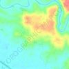
Singasari topographic map

Click on the map to display elevation.

About this map

Name: Singasari topographic map, elevation, terrain.

Location: Singasari, Tasikmalaya, West Java, Java, 46417, Indonesia (-7.36190 108.10736 -7.32190 108.14736)

Average elevation: 420 m

Minimum elevation: 365 m

Maximum elevation: 472 m

Other topographic maps

Click on a map to view its topography, its elevation and its terrain.

Cipatujah

Indonesia > West Java > Tasikmalaya

Average elevation: 165 m

Cipanas

Indonesia > West Java > Tasikmalaya

Average elevation: 117 m

Desa Arjasari

Indonesia > West Java > Tasikmalaya

Average elevation: 454 m

Desa Cimanuk

Indonesia > West Java > Tasikmalaya

Average elevation: 32 m

Gear up for your next adventure:

🎒Hiking Backpacks - Backpacks designed for hiking and trekking
📖Australian Bush Survival Books - Local knowledge on finding water and surviving the outback
💡Collapsible Camping Lanterns - Illuminate your base camp or tent for map studying at night
📱Tablet Tripod Mounts - Steady platforms for viewing digital maps or taking long exposures
📱Shockproof Phone Cases - Extra protection for your smartphone against drops on rocky terrain

As an Amazon Associate, this site earns from qualifying purchases at no extra cost to you.