Geolocate

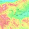
Mata topographic map

Click on the map to display elevation.

About this map

Name: Mata topographic map, elevation, terrain.

Location: Mata, Datong City, Shanxi, China (39.80263 113.64852 39.84263 113.68852)

Average elevation: 1,314 m

Minimum elevation: 1,213 m

Maximum elevation: 1,466 m

Other topographic maps

Click on a map to view its topography, its elevation and its terrain.

Yungang District

China > Shanxi > Datong City

Average elevation: 1,186 m

Yungang Grottoes

China > Shanxi > Datong City > Yungang

Average elevation: 1,164 m

Guangling County

China > Shanxi > Datong City

Average elevation: 1,424 m

Yungang

China > Shanxi > Datong City

Average elevation: 1,189 m

Gear up for your next adventure:

📍Handheld GPS - GPS devices for hiking and navigation
🕯️Emergency Whistles - Safety whistles for hiking
🎒Daypacks - Compact backpacks for short hikes
🌬️Windbreaker Jackets - Wind protection jackets
👄SPF Lip Balm - Prevent sun and wind-burnt lips on mountain ridges

As an Amazon Associate, this site earns from qualifying purchases at no extra cost to you.