Geolocate

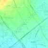
Parulog topographic map

Click on the map to display elevation.

About this map

Name: Parulog topographic map, elevation, terrain.

Location: Parulog, Santa Barbara, Bacolor, Pampanga, Central Luzon, 2001, Philippines (15.00350 120.63834 15.02023 120.65684)

Average elevation: 13 m

Minimum elevation: 5 m

Maximum elevation: 20 m

Other topographic maps

Click on a map to view its topography, its elevation and its terrain.

Talba

Philippines > Pampanga > Bacolor

Average elevation: 6 m

Parulog

Philippines > Pampanga > Bacolor

Average elevation: 12 m

San Antonio

Philippines > Pampanga > Bacolor

Average elevation: 18 m

Santa Ines

Philippines > Pampanga > Bacolor

Average elevation: 8 m

Potrero

Philippines > Pampanga > Bacolor

Average elevation: 38 m

Parulog

Philippines > Pampanga > Bacolor

Average elevation: 12 m

San Antonio

Philippines > Pampanga > Bacolor

Average elevation: 18 m

Santa Ines

Philippines > Pampanga > Bacolor

Average elevation: 8 m

Parulog

Philippines > Pampanga > Bacolor

Average elevation: 12 m

Gear up for your next adventure:

🎧Bluetooth Outdoor Earbuds - Listen to navigation cues or podcasts during long solo treks
🎽Hiking Clothing - Breathable clothing for hiking
🌧️Rain Jackets - Waterproof jackets for hiking
📱Shockproof Phone Cases - Extra protection for your smartphone against drops on rocky terrain
🛠️Outdoor Repair Kits - Gear repair kits

As an Amazon Associate, this site earns from qualifying purchases at no extra cost to you.