Geolocate

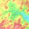
Stockhausen topographic map

Click on the map to display elevation.

About this map

Name: Stockhausen topographic map, elevation, terrain.

Location: Stockhausen, Herbstein, Vogelsbergkreis, Hesse, 36358, Germany (50.53200 9.37813 50.58122 9.49777)

Average elevation: 383 m

Minimum elevation: 254 m

Maximum elevation: 496 m

Other topographic maps

Click on a map to view its topography, its elevation and its terrain.

Schmitten

Germany > Hesse > Vogelsbergkreis > Sellnrod

Average elevation: 383 m

Dick

Germany > Hesse > Vogelsbergkreis

Average elevation: 378 m

Lauterbach

Germany > Hesse > Vogelsbergkreis

Average elevation: 361 m

Gear up for your next adventure:

🐍Australian Snake Bite Kits - Specific pressure immobilization bandages for Australian venomous snakes
🧊Insulated Stainless Steel Flasks - Keep water cold for 24 hours in the heat or coffee hot in the cold
🧢Wide Brim Sun Hats - Maximum coverage for the face and neck while out in the open
🧺Fast-Dry Microfiber Towels - Large towels that pack down to the size of an orange
🧊Insulated Cooler Bags - Keep food fresh for day trips to remote geographic sites

As an Amazon Associate, this site earns from qualifying purchases at no extra cost to you.