Geolocate

Farningham topographic map

Click on the map to display elevation.

About this map
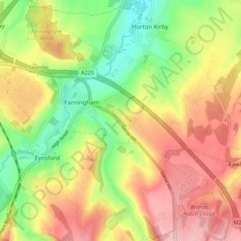
Name: Farningham topographic map, elevation, terrain.

Location: Farningham, Sevenoaks, Kent, England, United Kingdom (51.35143 0.19052 51.39803 0.25605)

Average elevation: 89 m

Minimum elevation: 16 m

Maximum elevation: 159 m

Gear up for your next adventure:

🔥Camping Stoves - Portable stoves for outdoor cooking
🧼Clip-on Hand Sanitizer - Maintain hygiene when water for washing is scarce
🥾Trail Running Shoes - Shoes for trail running
📚Map Reading & Navigation Guides - Master the art of interpreting topographic contours and symbols
🪢550 Survival Paracord - Versatile cordage for gear repair and emergency lashing

As an Amazon Associate, this site earns from qualifying purchases at no extra cost to you.