
Pointe du Lingustier topographic map
Interactive map
Click on the map to display elevation.
About this map
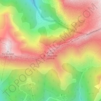
Name: Pointe du Lingustier topographic map, elevation, terrain.
Average elevation: 2,001 m
Minimum elevation: 1,507 m
Maximum elevation: 2,432 m
Other topographic maps
Click on a map to view its topography, its elevation and its terrain.
Torrent de Chau Creuse
France > Provence-Alpes-Côte d'Azur > La Motte-en-Champsaur
Torrent de Chau Creuse, La Motte-en-Champsaur, Gap, Hautes-Alpes, Provence-Alpes-Côte d'Azur, France métropolitaine, 05500, France
Average elevation: 1,899 m
Le Collet
France > Provence-Alpes-Côte d'Azur > La Motte-en-Champsaur > Le Collet
Le Collet, La Motte-en-Champsaur, Gap, Hautes-Alpes, Provence-Alpes-Côte d'Azur, France métropolitaine, 05500, France
Average elevation: 1,301 m