Geolocate

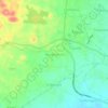
Cibeureum topographic map

Click on the map to display elevation.

About this map

Name: Cibeureum topographic map, elevation, terrain.

Location: Cibeureum, Tasikmalaya, West Java, Indonesia (-7.37682 108.22846 -7.33682 108.28840)

Average elevation: 331 m

Minimum elevation: 221 m

Maximum elevation: 376 m

Other topographic maps

Click on a map to view its topography, its elevation and its terrain.
Mangkubumi

Indonesia > West Java > Tasikmalaya

Average elevation: 370 m

Gear up for your next adventure:

🧤Hiking Gloves - Protective gloves for outdoor use
🍴Titanium Spork & Cutlery - Indestructible and feather-light eating utensils
📖Australian Bush Survival Books - Local knowledge on finding water and surviving the outback
🧦Hiking Socks - Comfortable socks for long hikes
🩹Blister Prevention Tape - Apply to friction points before they become painful sores

As an Amazon Associate, this site earns from qualifying purchases at no extra cost to you.