Geolocate

Burnham-on-Sea topographic map

Interactive map

Click on the map to display elevation.

About this map

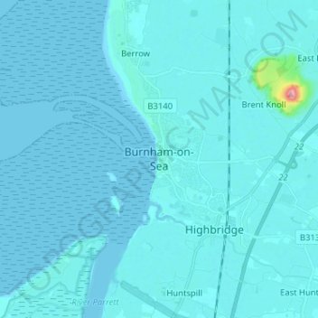
Name: Burnham-on-Sea topographic map, elevation, terrain.

Location: Burnham-on-Sea, Somerset, England, TA8 1BQ, United Kingdom (51.19774 -3.03870 51.27774 -2.95870)

Average elevation: 5 m

Minimum elevation: -2 m

Maximum elevation: 135 m

Other topographic maps

Click on a map to view its topography, its elevation and its terrain.

Curry Rivel

United Kingdom > England > Somerset

Average elevation: 23 m

Dulverton

United Kingdom > England > Somerset

Average elevation: 243 m

Wellington

United Kingdom > England > Somerset

Average elevation: 75 m

Bridgwater

United Kingdom > England > Somerset

Average elevation: 10 m

Shorney's Copse

United Kingdom > England > Somerset > Elworthy > Willett

Average elevation: 149 m

Cheddar

United Kingdom > England > Somerset

Average elevation: 109 m

Shepton Mallet

United Kingdom > England > Somerset

Average elevation: 173 m

Bruton

United Kingdom > England > Somerset

Average elevation: 105 m

Mendip

United Kingdom > England > Somerset

Average elevation: 98 m

Yeovil

United Kingdom > England > Somerset

Average elevation: 63 m

Wambrook

United Kingdom > England > Somerset > South Somerset > Wambrook

Average elevation: 184 m