
Oberriet topographic map
Interactive map
Click on the map to display elevation.
About this map
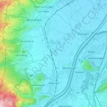
Name: Oberriet topographic map, elevation, terrain.
Location: Oberriet, Wahlkreis Rheintal, Sankt Gallen, Zwitserland (47.30412 9.49251 47.39108 9.63601)
Average elevation: 528 m
Minimum elevation: 404 m
Maximum elevation: 1,487 m
Oberriet is een gemeente en plaats in het Zwitserse kanton Sankt Gallen op ca. 420 meter hoogte en maakt deel uit van het district Rheintal. Oberriet telt ca. 8600 inwoners (2014).