Geolocate

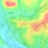
Nottingham Canal topographic map

Click on the map to display elevation.

About this map

Name: Nottingham Canal topographic map, elevation, terrain.

Location: Nottingham Canal, Cossall Marsh, Broxtowe, Nottinghamshire, England, NG16 2RU, United Kingdom (52.98218 -1.28875 52.98250 -1.28855)

Average elevation: 68 m

Minimum elevation: 43 m

Maximum elevation: 127 m

Other topographic maps

Click on a map to view its topography, its elevation and its terrain.
Kimberley

United Kingdom > England > Nottinghamshire > Broxtowe

Average elevation: 104 m

Brinsley

United Kingdom > England > Nottinghamshire > Broxtowe

Average elevation: 100 m

Beeston

United Kingdom > England > Nottinghamshire > Broxtowe

Average elevation: 39 m

Trowell

United Kingdom > England > Nottinghamshire > Broxtowe

Average elevation: 62 m

Nuthall

United Kingdom > England > Nottinghamshire > Broxtowe

Average elevation: 95 m

Moorgreen

United Kingdom > England > Nottinghamshire > Broxtowe

Average elevation: 105 m

Strelley

United Kingdom > England > Nottinghamshire > Broxtowe > Strelley

Average elevation: 100 m

Cossall

United Kingdom > England > Nottinghamshire > Broxtowe

Average elevation: 70 m

Awsworth

United Kingdom > England > Nottinghamshire > Broxtowe

Average elevation: 76 m

Beeston

United Kingdom > England > Nottinghamshire > Broxtowe

Average elevation: 44 m

Bramcote

United Kingdom > England > Nottinghamshire > Broxtowe

Average elevation: 55 m

Greasley

United Kingdom > England > Nottinghamshire > Broxtowe

Average elevation: 104 m

Stapleford

United Kingdom > England > Nottinghamshire > Broxtowe

Average elevation: 54 m

Awsworth

United Kingdom > England > Nottinghamshire > Broxtowe

Average elevation: 76 m

Beeston

United Kingdom > England > Nottinghamshire > Broxtowe

Average elevation: 39 m

Stapleford

United Kingdom > England > Nottinghamshire > Broxtowe

Average elevation: 54 m

Eastwood

United Kingdom > England > Nottinghamshire > Broxtowe

Average elevation: 81 m

Gear up for your next adventure:

🎽Base Layers - Thermal base layers
🔪Outdoor Multi-tools - Versatile tools for gear repair and survival tasks in the wilderness
🧊Insulated Cooler Bags - Keep food fresh for day trips to remote geographic sites
🛰️Handheld GPS Units - Rugged GPS devices for tracking coordinates and elevation in the Australian bush
🕶️Polarized Outdoor Sunglasses - Reduce glare from rocks and water for better visual navigation

As an Amazon Associate, this site earns from qualifying purchases at no extra cost to you.