Geolocate

Rotherwick topographic map

Click on the map to display elevation.

About this map
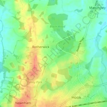
Name: Rotherwick topographic map, elevation, terrain.

Location: Rotherwick, Hart, Hampshire, England, United Kingdom (51.28369 -1.00230 51.31411 -0.94070)

Average elevation: 74 m

Minimum elevation: 54 m

Maximum elevation: 103 m

Gear up for your next adventure:

👄SPF Lip Balm - Prevent sun and wind-burnt lips on mountain ridges
🎽Hiking Clothing - Breathable clothing for hiking
⌚Altimeter Watches - Watches with altitude tracking
🎒Ultralight Backpacks - Lightweight packs for long hikes
🧦Hiking Socks - Comfortable socks for long hikes

As an Amazon Associate, this site earns from qualifying purchases at no extra cost to you.