
Fürholzen topographic map
Interactive map
Click on the map to display elevation.
About this map
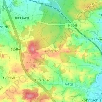
Name: Fürholzen topographic map, elevation, terrain.
Average elevation: 432 m
Minimum elevation: 391 m
Maximum elevation: 487 m
Other topographic maps
Click on a map to view its topography, its elevation and its terrain.
Straßhöfe
Deutschland > Bayern > Landkreis Pfaffenhofen an der Ilm > Rohrbach
Straßhöfe, Rohrbach, Landkreis Pfaffenhofen an der Ilm, Bayern, 85296, Deutschland
Average elevation: 426 m
Fahlenbach
Deutschland > Bayern > Landkreis Pfaffenhofen an der Ilm > Rohrbach
Fahlenbach, Rohrbach, Landkreis Pfaffenhofen an der Ilm, Bayern, 85296, Deutschland
Average elevation: 412 m