
Possession-Insel topographic map
Interactive map
Click on the map to display elevation.
About this map
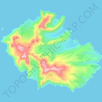
Name: Possession-Insel topographic map, elevation, terrain.
Average elevation: 138 m
Minimum elevation: -1 m
Maximum elevation: 900 m
Other topographic maps
Click on a map to view its topography, its elevation and its terrain.
Ost-Insel
Frankreich > Französische Süd- und Antarktisgebiete
Ost-Insel, Crozetarchipel, Französische Süd- und Antarktisgebiete, Frankreich
Average elevation: 135 m