
Espírito Santo do Pinhal topographic map
Interactive map
Click on the map to display elevation.
About this map
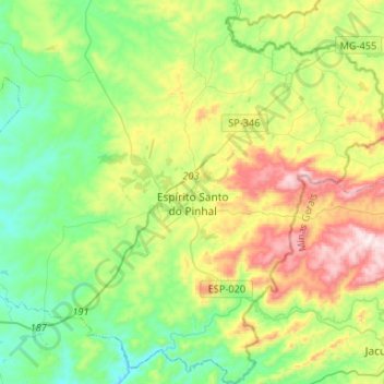
Name: Espírito Santo do Pinhal topographic map, elevation, terrain.
Average elevation: 847 m
Minimum elevation: 610 m
Maximum elevation: 1,339 m
Espírito Santo do Pinhal (Portuguese meaning "Holy Spirit of Pinhal") is a municipality in the state of São Paulo in Brazil. The population in 2020 is 44,471 (IBGE 2020) and the area is 389 km². The elevation is 870 m.