
Pierre Saint-Martin topographic map
Interactive map
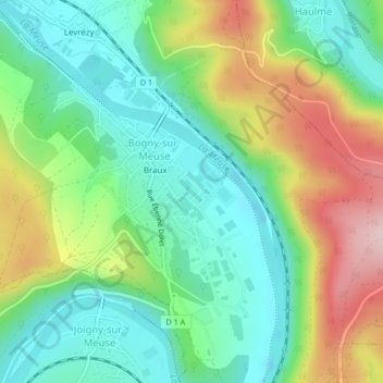
Click on the map to display elevation.
About this map
Name: Pierre Saint-Martin topographic map, elevation, terrain.
Average elevation: 212 m
Minimum elevation: 123 m
Maximum elevation: 374 m
Other topographic maps
Click on a map to view its topography, its elevation and its terrain.
Franc Bois
France > Grand Est > Ardennes > Bogny-sur-Meuse
Franc Bois, Bogny-sur-Meuse, Charleville-Mézières, Ardennes, Grand Est, France métropolitaine, 08120, France
Average elevation: 233 m