
Thank you for supporting this site ❤️
Make a donation
Make a donation
Gear up for your next adventure:
As an Amazon Associate, this site earns from qualifying purchases at no extra cost to you.
Alpetto topographic map
Click on the map to display elevation.
Thank you for supporting this site ❤️
Make a donation
Make a donation
Gear up for your next adventure:
As an Amazon Associate, this site earns from qualifying purchases at no extra cost to you.
About this map
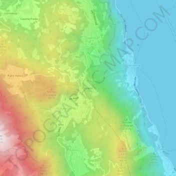
Name: Alpetto topographic map, elevation, terrain.
Location: Alpetto, Vassena, Oliveto Lario, Lecco, Lombardy, 23865, Italy (45.90535 9.24996 45.94535 9.28996)
Average elevation: 642 m
Minimum elevation: 194 m
Maximum elevation: 1,444 m
Thank you for supporting this site ❤️
Make a donation
Make a donation
Gear up for your next adventure:
As an Amazon Associate, this site earns from qualifying purchases at no extra cost to you.