
Make a donation
Gear up for your next adventure:
As an Amazon Associate, this site earns from qualifying purchases at no extra cost to you.
Regge topographic map
Click on the map to display elevation.
Make a donation
Gear up for your next adventure:
As an Amazon Associate, this site earns from qualifying purchases at no extra cost to you.
About this map
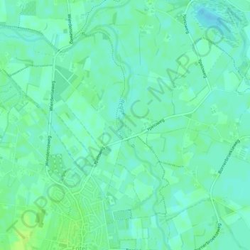
Name: Regge topographic map, elevation, terrain.
Location: Regge, Wierden, Overijssel, Nederland, 7468, Nederland (52.29833 6.57697 52.31873 6.59107)
Average elevation: 11 m
Minimum elevation: 6 m
Maximum elevation: 17 m
Make a donation
Gear up for your next adventure:
As an Amazon Associate, this site earns from qualifying purchases at no extra cost to you.
Other topographic maps
Click on a map to view its topography, its elevation and its terrain.
Wierden
Nederland > Overijssel > Wierden
De naam 'Wierden' wordt wel in verband gebracht met de ligging van een grote waterplas tussen Wierden en Almelo. Het zou te maken hebben met een kunstmatige hoogte ter bescherming tegen het water, zoals terpen, hillen, warden, wierden. Volgens velen lijkt deze afleiding niet waarschijnlijk, aangezien deze…
Average elevation: 11 m
Make a donation
Gear up for your next adventure:
As an Amazon Associate, this site earns from qualifying purchases at no extra cost to you.