
Kramfors kommun topographic map
Interactive map
Click on the map to display elevation.
About this map
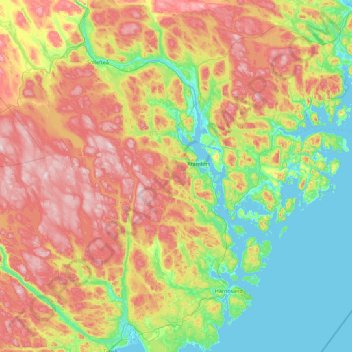
Name: Kramfors kommun topographic map, elevation, terrain.
Location: Kramfors kommun, Västernorrland County, Sweden (62.59578 17.17881 63.20533 18.98633)
Average elevation: 163 m
Minimum elevation: -4 m
Maximum elevation: 467 m
Other topographic maps
Click on a map to view its topography, its elevation and its terrain.
Kvarnsveden
Sweden > Västernorrland County > Nedansjö
Kvarnsveden, Nedansjö(gb), Stöde kommundel, Nedansjö, Sundsvall Municipality, Västernorrland County, Sweden
Average elevation: 141 m