Geolocate

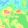
Lac Windfall topographic map

Click on the map to display elevation.

About this map

Name: Lac Windfall topographic map, elevation, terrain.

Location: Lac Windfall, Eeyou Istchee James Bay, Jamésie, Nord-du-Québec, Quebec, Canada (49.08180 -75.64798 49.10123 -75.63695)

Average elevation: 407 m

Minimum elevation: 379 m

Maximum elevation: 452 m

Other topographic maps

Click on a map to view its topography, its elevation and its terrain.

Lac Brigitte

Canada > Quebec > Jamésie > Eeyou Istchee James Bay

Average elevation: 414 m

Brisay

Canada > Quebec > Jamésie > Eeyou Istchee James Bay

Average elevation: 532 m

Gear up for your next adventure:

🧯Animal Deterrent Spray - Safety spray for wildlife
🥶Thermal Beanies - Warm hats for cold hikes
🌿Flora and Fauna Field Guides - Identify the plants and animals you encounter on your route
🧥Softshell Jackets - Flexible outdoor jackets
🎨Portable Watercolor Kits - Paint the landscapes and topographic views you discover

As an Amazon Associate, this site earns from qualifying purchases at no extra cost to you.