Geolocate

Colony topographic map

Click on the map to display elevation.

About this map

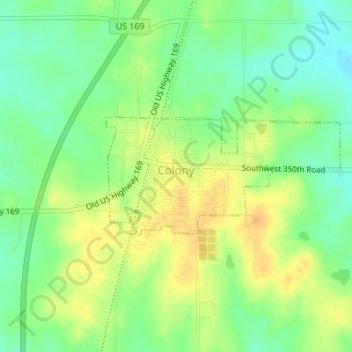
Name: Colony topographic map, elevation, terrain.

Location: Colony, Anderson County, Kansas, United States (38.06589 -95.37236 38.07491 -95.34950)

Average elevation: 339 m

Minimum elevation: 323 m

Maximum elevation: 354 m

Other topographic maps

Click on a map to view its topography, its elevation and its terrain.

Welda

United States > Kansas > Anderson County

Average elevation: 339 m

Gear up for your next adventure:

🎒Dry Bags - Waterproof bags for outdoor gear
🎒40L Day Hiking Backpacks - Comfortable packs with hydration support for long days exploring topographic peaks
📡Satellite Messengers - Emergency communication devices
🧴SPF 50+ Bulk Sunscreen - Maximum protection for long-term outdoor exposure
🔋Solar Power Banks - Solar chargers for outdoors

As an Amazon Associate, this site earns from qualifying purchases at no extra cost to you.