
Chappe topographic map
Interactive map
Click on the map to display elevation.
About this map
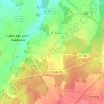
Name: Chappe topographic map, elevation, terrain.
Average elevation: 207 m
Minimum elevation: 174 m
Maximum elevation: 239 m
Other topographic maps
Click on a map to view its topography, its elevation and its terrain.
Le Gland
France > Centre-Val de Loire > Eure-et-Loir > Saint-Maixme-Hauterive
Le Gland, Saint-Maixme-Hauterive, Dreux, Eure-et-Loir, Centre-Val de Loire, France métropolitaine, 28170, France
Average elevation: 199 m