
Heusy topographic map
Interactive map
Click on the map to display elevation.
About this map
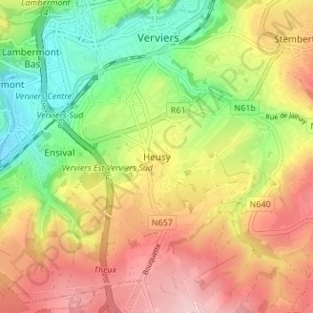
Name: Heusy topographic map, elevation, terrain.
Location: Heusy, Verviers, Luik, Wallonië, 4802, België (50.55804 5.84754 50.59804 5.88754)
Average elevation: 250 m
Minimum elevation: 145 m
Maximum elevation: 357 m