Geolocate

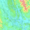
Putao topographic map

Click on the map to display elevation.

About this map

Name: Putao topographic map, elevation, terrain.

Location: Putao, Guilin, Guangxi, China (24.87377 110.33259 24.95377 110.41259)

Average elevation: 207 m

Minimum elevation: 153 m

Maximum elevation: 534 m

Other topographic maps

Click on a map to view its topography, its elevation and its terrain.

Lingui

China > Guangxi > Guilin

Average elevation: 190 m

Guanyang County

China > Guangxi > Guilin

Average elevation: 635 m

Yangshuo County

China > Guangxi > Guilin

Average elevation: 319 m

Longsheng

China > Guangxi > Guilin

Average elevation: 718 m

Yangshuo County

China > Guangxi > Guilin

Average elevation: 319 m

Yangshuo County

China > Guangxi > Guilin

Average elevation: 319 m

Yangshuo County

China > Guangxi > Guilin

Average elevation: 319 m

Pingle County

China > Guangxi > Guilin

Average elevation: 390 m

Xiangshan District

China > Guangxi > Guilin

Average elevation: 179 m

Pingle County

China > Guangxi > Guilin

Average elevation: 390 m

Gear up for your next adventure:

👣Snake & Scrub Gaiters - Protection against spinifex, mud, and snakes while walking off-track
🔋Rechargeable Batteries - Eco-friendly power for high-drain GPS units and flashlights
⌚GPS Watches - GPS watches for outdoor sports
🔑Heavy Duty Carabiners - Secure gear to the outside of your pack for easy access
🧊Insulated Stainless Steel Flasks - Keep water cold for 24 hours in the heat or coffee hot in the cold

As an Amazon Associate, this site earns from qualifying purchases at no extra cost to you.