
Sueras topographic map
Interactive map
Click on the map to display elevation.
About this map
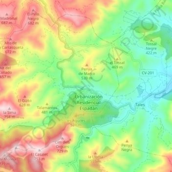
Name: Sueras topographic map, elevation, terrain.
Location: Sueras, Plana Baja, Castellón, Comunidad Valenciana, España (39.92773 -0.39578 39.98135 -0.31725)
Average elevation: 428 m
Minimum elevation: 205 m
Maximum elevation: 741 m