Geolocate

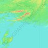
Bell Lake topographic map

Click on the map to display elevation.

About this map

Name: Bell Lake topographic map, elevation, terrain.

Location: Bell Lake, Killarney, Sudbury District, Northeastern Ontario, Ontario, Canada (46.12115 -81.24803 46.16263 -81.17568)

Average elevation: 237 m

Minimum elevation: 204 m

Maximum elevation: 281 m

Other topographic maps

Click on a map to view its topography, its elevation and its terrain.

Eagles Nest

Canada > Ontario > Sudbury District > Killarney

Average elevation: 191 m

Anchor Island

Canada > Ontario > Sudbury District > Killarney

Average elevation: 203 m

Gear up for your next adventure:

🚴Bike GPS - GPS devices for cycling
🧳Outdoor Travel Organizers - Gear organization accessories
🧢Outdoor Sun Hats - Sun protection hats for hiking
📦Crushproof Equipment Cases - Safe transport for sensitive surveying and mapping instruments
🩹Blister Prevention Tape - Apply to friction points before they become painful sores

As an Amazon Associate, this site earns from qualifying purchases at no extra cost to you.