
Thank you for supporting this site ❤️
Make a donation
Make a donation
Gear up for your next adventure:
As an Amazon Associate, this site earns from qualifying purchases at no extra cost to you.
Alpnachstad topographic map
Click on the map to display elevation.
Thank you for supporting this site ❤️
Make a donation
Make a donation
Gear up for your next adventure:
As an Amazon Associate, this site earns from qualifying purchases at no extra cost to you.
About this map
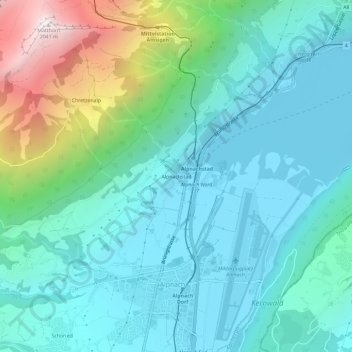
Name: Alpnachstad topographic map, elevation, terrain.
Location: Alpnachstad, Alpnach, Obwalden, 6053, Switzerland (46.93342 8.25434 46.97342 8.29434)
Average elevation: 765 m
Minimum elevation: 422 m
Maximum elevation: 2,031 m
Thank you for supporting this site ❤️
Make a donation
Make a donation
Gear up for your next adventure:
As an Amazon Associate, this site earns from qualifying purchases at no extra cost to you.