
Dudelange topographic map
Interactive map
Click on the map to display elevation.
About this map
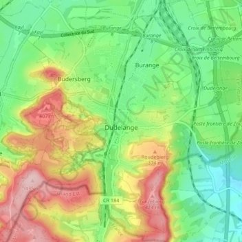
Name: Dudelange topographic map, elevation, terrain.
Location: Dudelange, Canton Esch-sur-Alzette, Luxembourg (49.45289 6.04750 49.50705 6.12804)
Average elevation: 317 m
Minimum elevation: 234 m
Maximum elevation: 441 m
Other topographic maps
Click on a map to view its topography, its elevation and its terrain.
Kayl
Luxembourg > Canton Esch-sur-Alzette
Kayl, Canton Esch-sur-Alzette, Luxembourg
Average elevation: 341 m