
Pikatua topographic map
Interactive map
Click on the map to display elevation.
About this map
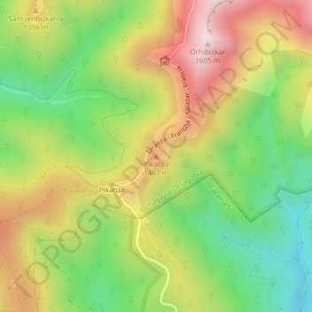
Name: Pikatua topographic map, elevation, terrain.
Location: Pikatua, Ochagavía/Otsagabia, Pirinioak / Pirineo, Espagne (42.95903 -1.01017 42.95913 -1.01007)
Average elevation: 1,250 m
Minimum elevation: 959 m
Maximum elevation: 1,594 m
Other topographic maps
Click on a map to view its topography, its elevation and its terrain.
Iratiko etxeak
Espagne > Pirinioak / Pirineo > Ochagavía/Otsagabia
Iratiko etxeak, Ochagavía/Otsagabia, Pirinioak / Pirineo, Espagne
Average elevation: 1,031 m