
Hertberg topographic map
Interactive map
Click on the map to display elevation.
About this map
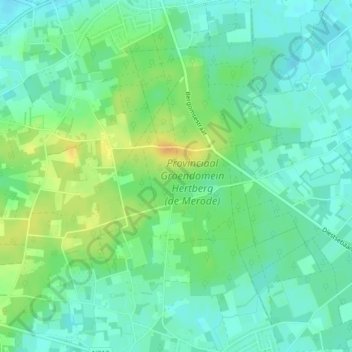
Name: Hertberg topographic map, elevation, terrain.
Location: Hertberg, Herselt, Turnhout, Antwerpen, Vlaanderen, België (51.04714 4.90283 51.07400 4.94369)
Average elevation: 23 m
Minimum elevation: 12 m
Maximum elevation: 41 m
Other topographic maps
Click on a map to view its topography, its elevation and its terrain.