
Sant Antoni topographic map
Interactive map
Click on the map to display elevation.
About this map
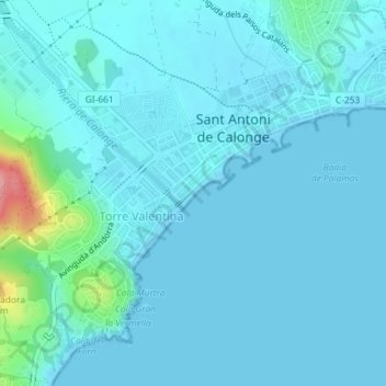
Name: Sant Antoni topographic map, elevation, terrain.
Average elevation: 13 m
Minimum elevation: 0 m
Maximum elevation: 126 m
Other topographic maps
Click on a map to view its topography, its elevation and its terrain.
Calonge
Espagne > Catalogne > Bas-Ampurdan > Calonge i Sant Antoni
Calonge, Calonge i Sant Antoni, Bas-Ampurdan, Gérone, Catalogne, 17251, Espagne
Average elevation: 116 m