
Thank you for supporting this site ❤️
Make a donation
Make a donation
Gear up for your next adventure:
As an Amazon Associate, this site earns from qualifying purchases at no extra cost to you.
Ponterwyd topographic map
Click on the map to display elevation.
Thank you for supporting this site ❤️
Make a donation
Make a donation
Gear up for your next adventure:
As an Amazon Associate, this site earns from qualifying purchases at no extra cost to you.
About this map
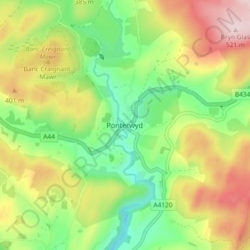
Name: Ponterwyd topographic map, elevation, terrain.
Location: Ponterwyd, Ceredigion, Wales, SY23 3JU, United Kingdom (52.39155 -3.86023 52.43155 -3.82023)
Average elevation: 321 m
Minimum elevation: 178 m
Maximum elevation: 514 m
Thank you for supporting this site ❤️
Make a donation
Make a donation
Gear up for your next adventure:
As an Amazon Associate, this site earns from qualifying purchases at no extra cost to you.