
Thank you for supporting this site ❤️
Make a donation
Make a donation
Gear up for your next adventure:
As an Amazon Associate, this site earns from qualifying purchases at no extra cost to you.
Mokhotlong topographic map
Click on the map to display elevation.
Thank you for supporting this site ❤️
Make a donation
Make a donation
Gear up for your next adventure:
As an Amazon Associate, this site earns from qualifying purchases at no extra cost to you.
About this map
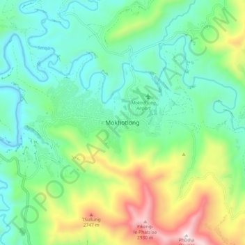
Name: Mokhotlong topographic map, elevation, terrain.
Location: Mokhotlong, Mokhotlong District, Lesotho (-29.32942 29.02317 -29.24942 29.10317)
Average elevation: 2,293 m
Minimum elevation: 2,006 m
Maximum elevation: 2,995 m
Thank you for supporting this site ❤️
Make a donation
Make a donation
Gear up for your next adventure:
As an Amazon Associate, this site earns from qualifying purchases at no extra cost to you.