Geolocate

Wool topographic map

Click on the map to display elevation.

About this map
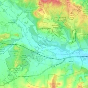
Name: Wool topographic map, elevation, terrain.

Location: Wool, Bovington, Dorset, England, United Kingdom (50.66210 -2.27022 50.71784 -2.19449)

Average elevation: 37 m

Minimum elevation: 10 m

Maximum elevation: 92 m

Gear up for your next adventure:

🛰️Handheld GPS Units - Rugged GPS devices for tracking coordinates and elevation in the Australian bush
🧥Insulated Down Jackets - High warmth-to-weight ratio for cold nights in the high country
👣Snake & Scrub Gaiters - Protection against spinifex, mud, and snakes while walking off-track
📣High-Decibel Survival Whistles - Signaling tool for rescue that carries much further than a human voice
🧦Merino Wool Hiking Socks - Moisture-wicking socks to prevent blisters during long topographic surveys

As an Amazon Associate, this site earns from qualifying purchases at no extra cost to you.