Geolocate

Lae topographic map

Click on the map to display elevation.

About this map

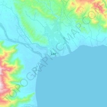
Name: Lae topographic map, elevation, terrain.

Location: Lae, Lae District, Morobe, Momase Region, Papua New Guinea (-6.89020 146.84081 -6.57020 147.16081)

Average elevation: 162 m

Minimum elevation: 0 m

Maximum elevation: 1,702 m

Other topographic maps

Click on a map to view its topography, its elevation and its terrain.

Butibum River

Papua New Guinea > Morobe > Lae District > Lae

Average elevation: 71 m

Gear up for your next adventure:

🧰Survival Kits - Essential survival gear
🧼Biodegradable Soap - Eco-friendly outdoor soap
🪫Rechargeable Headlamps - USB rechargeable headlamps
🎒40L Day Hiking Backpacks - Comfortable packs with hydration support for long days exploring topographic peaks
🕶️Polarized Sunglasses - UV protection sunglasses for outdoors

As an Amazon Associate, this site earns from qualifying purchases at no extra cost to you.