
Make a donation
Gear up for your next adventure:
As an Amazon Associate, this site earns from qualifying purchases at no extra cost to you.
Lees Mill topographic map
Click on the map to display elevation.
Make a donation
Gear up for your next adventure:
As an Amazon Associate, this site earns from qualifying purchases at no extra cost to you.
About this map
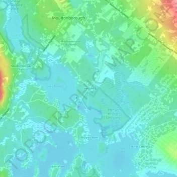
Name: Lees Mill topographic map, elevation, terrain.
Average elevation: 173 m
Minimum elevation: 149 m
Maximum elevation: 270 m
Make a donation
Gear up for your next adventure:
As an Amazon Associate, this site earns from qualifying purchases at no extra cost to you.
Other topographic maps
Click on a map to view its topography, its elevation and its terrain.
Castle in the Clouds
United States > New Hampshire > Carroll County > Moultonborough
Average elevation: 363 m
Black Cat Island
United States > New Hampshire > Carroll County > Moultonborough
Average elevation: 156 m
Nineacre Island
United States > New Hampshire > Carroll County > Moultonborough
Average elevation: 158 m