Geolocate

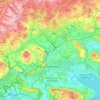
Horn topographic map

Click on the map to display elevation.

About this map

Name: Horn topographic map, elevation, terrain.

Location: Horn, Gaienhofen, Verwaltungsgemeinschaft Höri, Landkreis Konstanz, Baden-Württemberg, 78343, Germany (47.67429 8.97329 47.71429 9.01329)

Average elevation: 416 m

Minimum elevation: 392 m

Maximum elevation: 513 m

Other topographic maps

Click on a map to view its topography, its elevation and its terrain.

Hegau

Germany > Baden-Württemberg > Landkreis Konstanz

Average elevation: 539 m

78234

Germany > Baden-Württemberg > Landkreis Konstanz > Engen

Average elevation: 636 m

Gear up for your next adventure:

📷Backpack Camera Clips - Quick access to your camera while keeping your hands free for climbing
🧳Outdoor Travel Organizers - Gear organization accessories
🦶Orthotic Hiking Insoles - Extra arch support for long-distance topographic treks
🦟Heavy Duty Insect Repellent - Essential protection against flies, mozzies, and march flies
📟Satellite Messengers - Two-way satellite communication to stay in touch beyond the cellular grid

As an Amazon Associate, this site earns from qualifying purchases at no extra cost to you.