
Thank you for supporting this site ❤️
Make a donation
Make a donation
Gear up for your next adventure:
As an Amazon Associate, this site earns from qualifying purchases at no extra cost to you.
Chama topographic map
Click on the map to display elevation.
Thank you for supporting this site ❤️
Make a donation
Make a donation
Gear up for your next adventure:
As an Amazon Associate, this site earns from qualifying purchases at no extra cost to you.
About this map
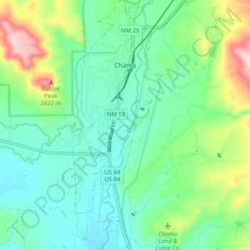
Name: Chama topographic map, elevation, terrain.
Location: Chama, Rio Arriba County, New Mexico, 87520, United States (36.86093 -106.59486 36.91874 -106.57231)
Average elevation: 2,430 m
Minimum elevation: 2,345 m
Maximum elevation: 2,668 m
Thank you for supporting this site ❤️
Make a donation
Make a donation
Gear up for your next adventure:
As an Amazon Associate, this site earns from qualifying purchases at no extra cost to you.