
Ottré topographic map
Interactive map
Click on the map to display elevation.
About this map
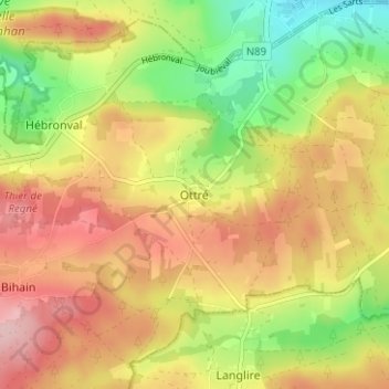
Name: Ottré topographic map, elevation, terrain.
Location: Ottré, Vielsalm, Bastenaken, Luxemburg, Wallonië, 6690, België (50.22855 5.81653 50.26855 5.85653)
Average elevation: 517 m
Minimum elevation: 425 m
Maximum elevation: 599 m