
Thank you for supporting this site ❤️
Make a donation
Make a donation
Gear up for your next adventure:
As an Amazon Associate, this site earns from qualifying purchases at no extra cost to you.
Lantan topographic map
Click on the map to display elevation.
Thank you for supporting this site ❤️
Make a donation
Make a donation
Gear up for your next adventure:
As an Amazon Associate, this site earns from qualifying purchases at no extra cost to you.
About this map
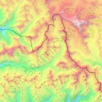
Name: Lantan topographic map, elevation, terrain.
Location: Lantan, Gosaikund, Rasuwa, Bagmati Pradesh, Nepal (28.12981 85.39995 28.38583 85.80045)
Average elevation: 5,161 m
Minimum elevation: 2,923 m
Maximum elevation: 8,000 m
Thank you for supporting this site ❤️
Make a donation
Make a donation
Gear up for your next adventure:
As an Amazon Associate, this site earns from qualifying purchases at no extra cost to you.