Lake Saint-Louis topographic map
Interactive map
Click on the map to display elevation.
About this map
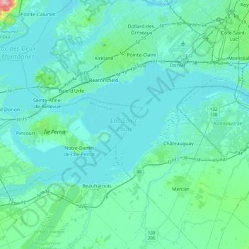
Name: Lake Saint-Louis topographic map, elevation, terrain.
Average elevation: 34 m
Minimum elevation: 16 m
Maximum elevation: 205 m

Click on the map to display elevation.
Name: Lake Saint-Louis topographic map, elevation, terrain.
Average elevation: 34 m
Minimum elevation: 16 m
Maximum elevation: 205 m