
Thank you for supporting this site ❤️
Make a donation
Make a donation
Gear up for your next adventure:
As an Amazon Associate, this site earns from qualifying purchases at no extra cost to you.
Kalanwada topographic map
Click on the map to display elevation.
Thank you for supporting this site ❤️
Make a donation
Make a donation
Gear up for your next adventure:
As an Amazon Associate, this site earns from qualifying purchases at no extra cost to you.
About this map
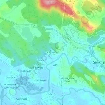
Name: Kalanwada topographic map, elevation, terrain.
Location: Kalanwada, Karapur, Bicholim, North Goa, Goa, 403505, India (15.54631 73.97289 15.58631 74.01289)
Average elevation: 36 m
Minimum elevation: -1 m
Maximum elevation: 163 m
Thank you for supporting this site ❤️
Make a donation
Make a donation
Gear up for your next adventure:
As an Amazon Associate, this site earns from qualifying purchases at no extra cost to you.