
Hartland topographic map
Interactive map
Click on the map to display elevation.
About this map
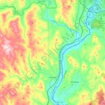
Name: Hartland topographic map, elevation, terrain.
Location: Hartland, Windsor County, Vermont, États-Unis (43.51976 -72.52899 43.63106 -72.32794)
Average elevation: 261 m
Minimum elevation: 87 m
Maximum elevation: 545 m