Geolocate

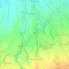
Biclatan topographic map

Click on the map to display elevation.

About this map

Name: Biclatan topographic map, elevation, terrain.

Location: Biclatan, General Trias, Cavite, Calabarzon, 4107, Philippines (14.26519 120.89908 14.28921 120.92668)

Average elevation: 153 m

Minimum elevation: 111 m

Maximum elevation: 190 m

Other topographic maps

Click on a map to view its topography, its elevation and its terrain.
Tapia

Philippines > Cavite > General Trias > Tapia

Average elevation: 32 m

Malabon River

Philippines > Cavite > General Trias

Average elevation: 16 m

Kaliwa Dam

Philippines > Cavite > General Trias

Average elevation: 22 m

Block 22

Philippines > Cavite > General Trias

Average elevation: 26 m

Kaliwa Dam

Philippines > Cavite > General Trias

Average elevation: 22 m

Kaliwa Dam

Philippines > Cavite > General Trias

Average elevation: 22 m

Gear up for your next adventure:

🛌Compact Down Sleeping Bags - Warmth without the bulk, ideal for backcountry camping
🧦Hiking Socks - Comfortable socks for long hikes
🧼Biodegradable Soap - Eco-friendly outdoor soap
🪑Portable Backpacking Chairs - A comfortable seat for studying maps at the end of the day
🦟Heavy Duty Insect Repellent - Essential protection against flies, mozzies, and march flies

As an Amazon Associate, this site earns from qualifying purchases at no extra cost to you.