
Orcières-Merlette topographic map
Interactive map
Click on the map to display elevation.
About this map
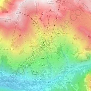
Name: Orcières-Merlette topographic map, elevation, terrain.
Average elevation: 1,874 m
Minimum elevation: 1,256 m
Maximum elevation: 2,509 m
Other topographic maps
Click on a map to view its topography, its elevation and its terrain.
Les Estaris
France > Provence-Alpes-Côte d'Azur > Hautes-Alpes > Orcières
Les Estaris, Orcières, Gap, Hautes-Alpes, Provence-Alpes-Côte d'Azur, Metropolitan France, 05170, France
Average elevation: 1,837 m