Geolocate

Albogasio topographic map

Click on the map to display elevation.

About this map

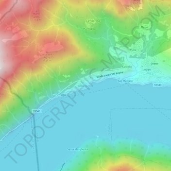
Name: Albogasio topographic map, elevation, terrain.

Location: Albogasio, Valsolda, Como, Lombardy, Italy (46.00364 9.02019 46.04364 9.06019)

Average elevation: 570 m

Minimum elevation: 245 m

Maximum elevation: 1,373 m

Gear up for your next adventure:

🔥Windproof Plasma Lighters - USB rechargeable lighters that work in high-altitude winds
🦟Insect Repellent - Protection against insects
🧣Merino Neck Gaiters - Versatile headwear for warmth, sun protection, or dust filtering
🧤Hiking Gloves - Protective gloves for outdoor use
🥤Hydration Packs - Hydration systems for hiking

As an Amazon Associate, this site earns from qualifying purchases at no extra cost to you.