
Le Bacon topographic map
Interactive map
Click on the map to display elevation.
About this map
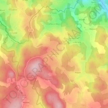
Name: Le Bacon topographic map, elevation, terrain.
Average elevation: 1,072 m
Minimum elevation: 928 m
Maximum elevation: 1,165 m
Other topographic maps
Click on a map to view its topography, its elevation and its terrain.
Tremoulouzet
France > Occitanie > Lozère > Les Monts-Verts > Le Bacon > Tremoulouzet
Tremoulouzet, Le Bacon, Les Monts-Verts, Mende, Lozère, Occitanie, France métropolitaine, 48200, France
Average elevation: 1,049 m