
Thank you for supporting this site ❤️
Make a donation
Make a donation
Gear up for your next adventure:
As an Amazon Associate, this site earns from qualifying purchases at no extra cost to you.
Edsbruk topographic map
Click on the map to display elevation.
Thank you for supporting this site ❤️
Make a donation
Make a donation
Gear up for your next adventure:
As an Amazon Associate, this site earns from qualifying purchases at no extra cost to you.
About this map
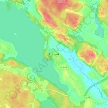
Name: Edsbruk topographic map, elevation, terrain.
Location: Edsbruk, Västerviks kommun, Kalmar County, 594 75, Sweden (57.99958 16.44746 58.03958 16.48746)
Average elevation: 32 m
Minimum elevation: 0 m
Maximum elevation: 84 m
Thank you for supporting this site ❤️
Make a donation
Make a donation
Gear up for your next adventure:
As an Amazon Associate, this site earns from qualifying purchases at no extra cost to you.